
If you’ve seen claims that national forest trails are now open to dirt bikes, the official record says something different. The Forest Service has started a rulemaking that would tilt its travel-management rules toward access. This rulemaking hasn’t opened, closed or re-designated a single trail yet.
The document behind the talk is a notice of intent to prepare an environmental impact statement, published in the Federal Register on Aug. 24, 2026. A notice of intent is the opening step of a long process, not a final rule. The public comment window on it closed Sept. 23.
Key points:
- What it is: a proposal to revise the Forest Service’s travel-management regulations (36 CFR part 212) and related rules.
- What it isn’t: a change to the legal status of any road or trail. The notice says so in plain terms.
- What still governs: the motor vehicle use maps (MVUMs) and designations already in effect.
- What’s next: a proposed rule and draft environmental impact statement (EIS) that the agency expects in spring 2027.
What the Forest Service actually proposed
The notice comes out of a May 29, 2026 executive order, E.O. 14408, which rescinded two older orders (11644 and 11989) that the current travel-management rules were built on. It told agencies to start rulemaking to rescind or revise the regulations that implemented them.
The USDA’s answer is a proposed “uniform national policy favoring increased access.” The notice describes several pieces:
- An open-unless-closed presumption. Existing roads, trails and other access points on National Forest System land would be presumed open to appropriate public use, unless a closure or restriction is required by law, valid existing rights or another governing instrument, or is supported by “specific, documented and justifiable reasons.” The listed reasons are science-based resource conditions, public safety, conflicts among uses, and maintenance and administrative capacity. Seasonal restrictions could still apply.
- An annual review of closed routes. Each unit would, subject to available appropriations, review trails and roads that are closed or highly restricted, and flag ones that may warrant reconsideration.
- A look at new routes. Officials would be required to consider new roads, trails and trailheads where appropriate to increase access, though the policy wouldn’t itself authorize construction.
- Limited off-route motor use. The rule would set processes for things like retrieving downed big game, collecting firewood and dispersed camping, plus designating areas for over-snow and other motorized recreation.
- Fewer national design rules. The current “minimization criteria” used when designating routes would be removed, with local officials deciding on documented local conditions. The agency also wants to separate clerical map corrections and minor designation revisions from bigger changes, so small updates need less process.
The notice also proposes that class 1 electric bicycles, as defined in federal law, be exempt from the motor vehicle use designation requirement when ridden on a trail where bicycles are allowed. That’s a bicycle issue rather than a motorcycle one, but it shows the rule isn’t only about engines.
Why your local trail hasn’t changed
The most important lines for a rider are a few paragraphs in the summary. The access presumption “would guide future decisions and would not itself change the legal status of any road, trail, airfield, trailhead, area, or other access route or point.” And: “Existing motor vehicle use designations and maps would remain in effect until revised under the amended regulations.”
Later the notice repeats it in a slightly different form. The presumption “would not itself open a currently closed route,” except where the amended regulations expressly make a specific vehicle or use exemption take effect on its own. It adds that prohibitions set by other authorities stay in effect until those authorities modify, rescind or let them expire.
So, at the moment:
- A trail that’s closed to motorcycles on your forest’s MVUM is still closed.
- A trail that’s open on the MVUM is open under the same conditions and seasons as before.
- A route you can see on satellite imagery isn’t necessarily a legal route. The notice says public datasets such as aerial imagery may be used as evidence that a physical route exists, but “would not by themselves establish” that it’s part of the forest transportation system, that the Forest Service has jurisdiction or legal access, or that it’s open to a particular use.
That last point matters for riders who navigate from a phone app with a map layer. An app line is not a legal designation.
How to check a trail before you ride
The notice says that since 2005, all but 6 of the 154 national forest units and 20 national grassland units have established motor vehicle use maps.
Where a map exists, it’s the document that says which roads, trails and areas are designated for public motor vehicle use. The notice describes those maps as showing “where, when, and which motor vehicle uses were permitted.”
Here’s a practical order of operations:
- Find the MVUM for the forest or grassland you’re riding. Start from the forest’s own Forest Service page or the ranger district office.
- Check the designation for your vehicle class. A road may be open to highway-legal vehicles only, or a trail may be open to motorcycles but not larger vehicles. The map says which.
- Look at the season. Designations can carry dates. A trail that’s open in July may not be in April.
- Confirm with the ranger district. Wildfire, flood damage, closure orders and temporary restrictions may not be on a map you downloaded months ago.
- Go by the ground. Signs, gates and posted closure orders at the trailhead count.
The Forest Service notice also says the national rule would keep requiring digital maps that show access rules for roads, trails and access points, and would make them the authoritative public source for designations. So the map habit isn’t going away. It’s likely to matter more.
What could change, and when
The timeline in the notice is a forecast. The USDA says it anticipates publishing the proposed rule and draft EIS in spring 2027, and the completed EIS, record of decision and final rule in early calendar year 2028. It adds that this “schedule is subject to change consistent with applicable law.”
Some more things to know about how this will unfold:
- Comments are closed. The 30-day written comment period ended Sept. 23, 2026, and no separate scoping meetings were planned. There’s supposed to be another opportunity to comment when the proposed rule and draft EIS come out.
- The EIS will compare options. Besides the proposal, the agency will study a no-action alternative that keeps today’s rule. It lists possible alternatives such as applying the open-unless-closed presumption only going forward, limiting what counts as an “existing” route to ones in the forest transportation atlas, and keeping some of the current designation and public-involvement steps.
- Local decisions remain local. Even under the proposal, changes to specific routes would come from local officials after analysis of land and resource conditions. The notice says it would not by itself open a route, and the EIS will look at programmatic effects rather than predicting trail-by-trail outcomes.
- Other laws stay in play. The notice lists the Clean Water Act, Clean Air Act, Endangered Species Act, National Trails System Act, National Historic Preservation Act and Wilderness Act among the laws designations must still comply with.
Put simply, the earliest a rider would see a change in a route’s legal status from this process is after the proposed rule turns into a final rule and a local unit acts under it. Nothing in the notice gives a date for any specific forest.
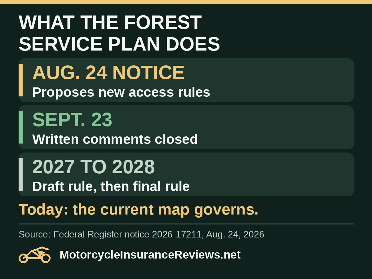
Federal Register notice 2026-17211, Aug. 24, 2026. Spring 2027 and early 2028 are the agency’s forecasts and subject to change.
Riding without guessing
The notice itself says the purpose is deregulatory, meant to make travel planning “less burdensome, more efficient and timelier.”
What “appropriate public use,” science-based closure reasons and maintenance capacity mean in practice, and how many closed routes are actually reopened, are questions the EIS is meant to examine.
For the rider on the trail this weekend, none of that changes what to check. The current map and the current posted conditions decide whether you can ride a route.
Two habits are worth keeping:
- Save the map and the date. If you download an MVUM, note when you got it and recheck before a trip, since designations can be revised.
- Treat social media trail claims as leads, not permission. A post saying a route “opened” should be checked against the forest’s own page or the ranger district.
Note: this reflects the Forest Service proposal as of Sept. 30, 2026. It doesn’t describe any specific forest’s routes and isn’t legal advice. A later Federal Register notice, proposed rule or forest-level order would supersede it.
References
- Federal Register notice 2026-17211: Travel Management; National Forest System Lands (Aug. 24, 2026) — Notice of intent to prepare an EIS; proposed access presumption, annual review, off-route uses, class 1 e-bike exemption, comment deadline of Sept. 23, 2026, existing designations and maps remaining in effect, and the spring 2027 and early 2028 schedule.
- White House Executive Order 14408, Removing Unnecessary and Counterproductive Restrictions on Access to Federal Lands (May 29, 2026) — Policy direction that led to the rulemaking; it does not designate any trail open.
- Forest Service Motor Vehicle Use Map trail data service — Forest Service data layer for trails designated on motor vehicle use maps; a map or data layer does not replace posted conditions.